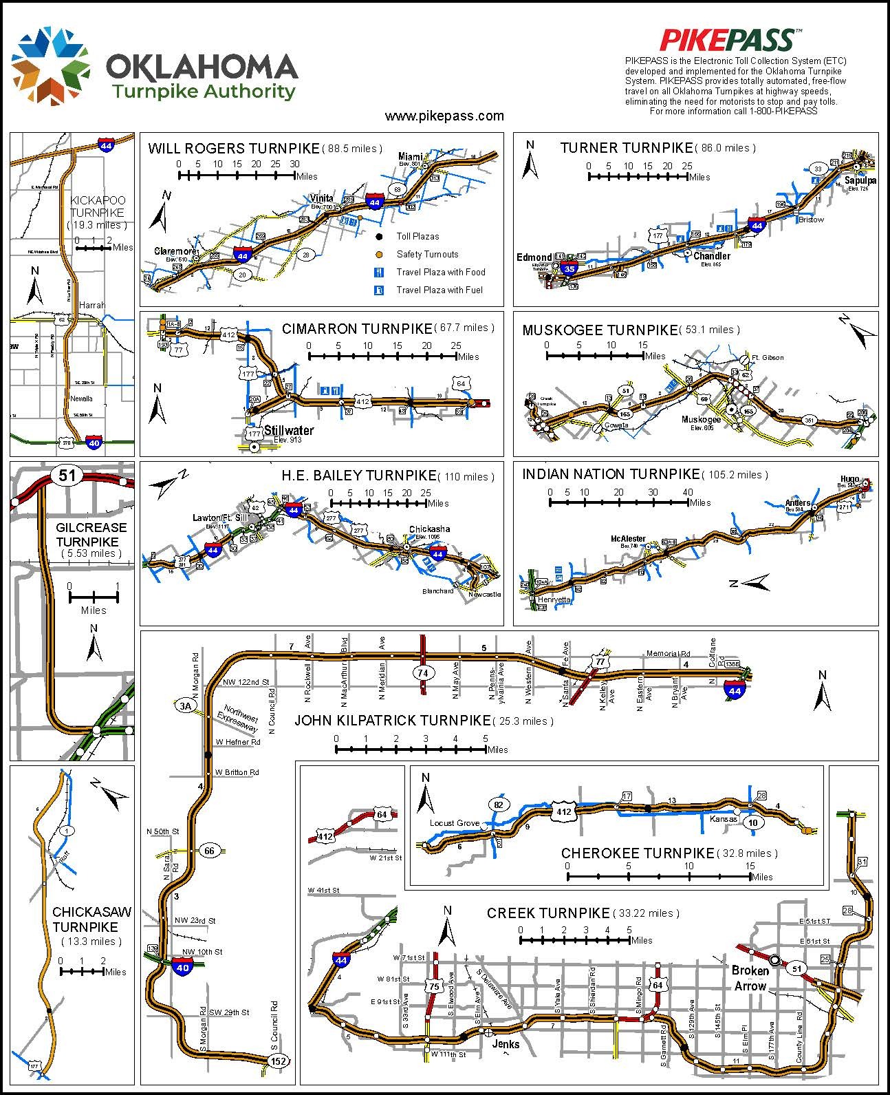
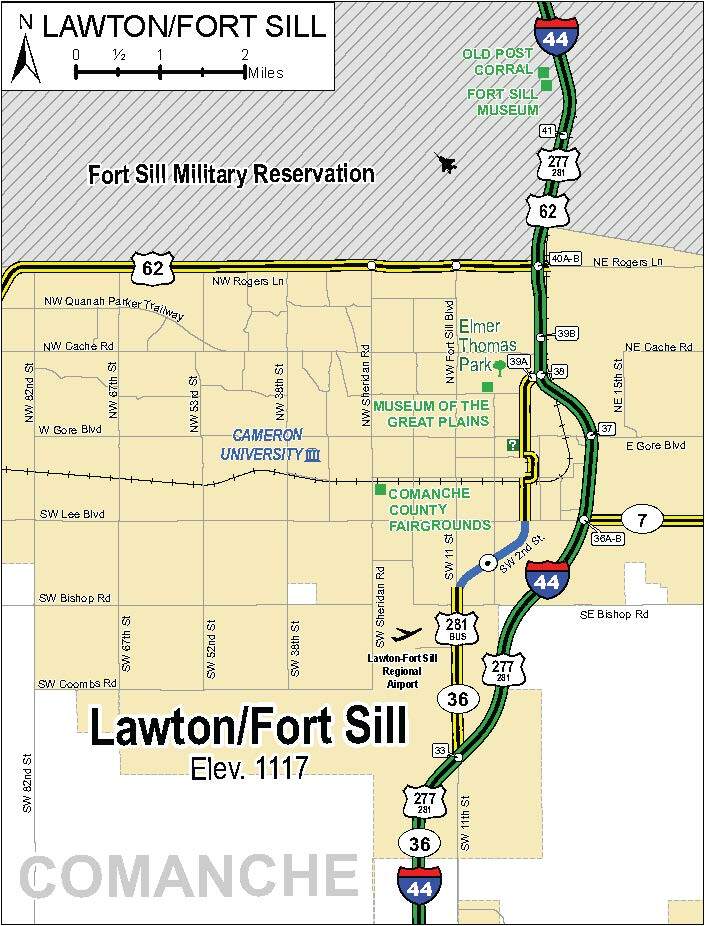
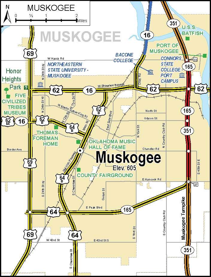
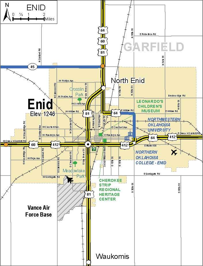
Maps
Official Oklahoma State Maps
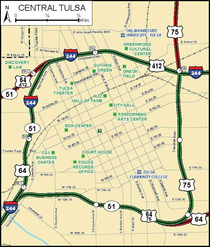
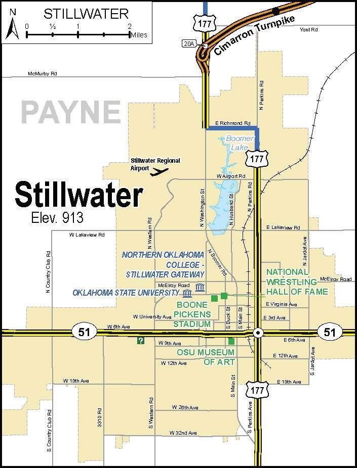
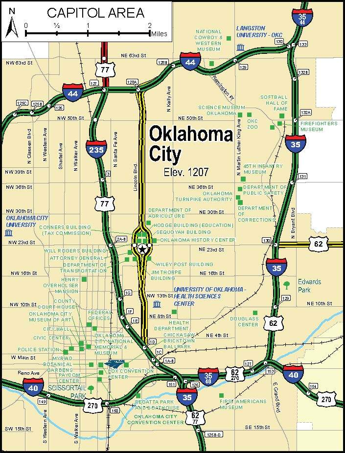
Click on an image below to open the Official Oklahoma State Highway Map or any of the individual city map insets. You may view, save or print these maps.
Click on an image below to open the Official Oklahoma State Highway Map or any of the individual city map insets. You may view, save or print these maps.